NASA Launches Sat Tracking Ice Melt Saturday

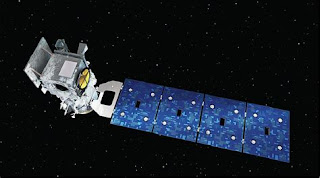
Satellite will Provide Vital Information on Climate Change's Impact Image of NASA's ICESat-2 ICESat-2 NASA will launch its ICESat-2 satellite that will track the Earth's melting poles and disappearing sea ice on Saturday Sept. 15. It will document how ice sheets, glaciers and sea ice are changing. And the information will help to generate new insights into how the changes are impacting people, animals and the environment. The data also will be used to forecast conditions going forward. NASA's Most Advanced Laser ICESat-2 is NASA's most advanced laser instrument. It measures the height of glaciers and sea ice by precisely timing how long it takes individual photons to leave the satellite, bounce off the earth and return to the sat. The laser beam splits into 6 beams to cover more ground. The mission will last for 3 years.