Posts

Showing posts with the label #sea levels

New Climate Change Acceleration Results

Image
Greenland's Ice Melt 60% More Than Expected by 2100 Source:  Greenland Not So Subtle Signs from Nature A new research study by scientists at the University of Liege Belgium demonstrates that the effects of Climate Change on the ice melt in Greenland and the Arctic are far worse than previously predicted.  The scientific team used revised climate models that they say are far more accurate.  They found that the Greenland ice melt by 2100 will be 60% more than expected.  Greenland's ice sheet is the second largest in the world.  Rising water levels from the melt will have very serious consequences. Messages of Accelerating Climate Change From Nature Should the Greenland ice sheet completely melt, the scientists say that would cause sea levels to rise 23 feet.  The study says the Netherlands would be completely under water, Denmark would be a lot smaller and some cities in the Atlantic coastal regions of the US could be submerged.  The scientists add there are many signs from natur

NASA-ESA Sat Monitors Oceans Globally

Image
  SAT to Precisely Measure Climate Change Impact on Oceans                                                  Source:  NASA & ESA Keeping a Watchful Eye on Oceans & Climate Change A new NASA and European Space Agency (ESA) satellite to precisely measure rising sea levels from climate change was launched into orbit this weekend onboard a SpaceX Falcon 9 rocket, from California.  The satellite will be able to precisely measures sea levels on 90% of the world's oceans.  This is the latest in a series of ocean monitoring satellites.  But the technologies on this satellite are so precise they will be able to provide sea level measurements within a few centimeters. Weather Forecasting Data Assistance According to NASA, the new satellite will also help improve the accuracy of weather forecasts as it will provide new, in-depth data on humidity levels and atmospheric pressure.  The satellite is named the Sentinel-6 Michael Freilich after NASA former director Michael Freilich who is co

NASA to Track Earth's Ice Melt

Image
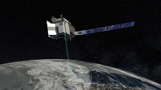
Satellite with Most Advanced Laser Altimeter to Track Global Ice Melt ICESAT-2 In mid-September, NASA will launch ICESAT-2.  It's a $1 billion satellite loaded with the most advanced laser system NASA has ever launched into space.  The purpose is to track and precisely document how the earth's ice sheets, sea ice and glaciers are melting.  NASA officials think more than 2/3rds of the earth's ice has melted since the 1980's. Ice Mission ICESAT-2 is going to provide an unprecedented level of detail and precision on how ice sheets' heights and thickness are changing. It's a 3 year mission and the highly advanced laser onboard adds the 3rd dimension to the measuring.  The system is so precise it can document increases and decreases in ice thickness as small as 1/5 of an inch. "Revolutionary" Technology NASA says this instrument is "revolutionary" to study both land and sea ice.  The laser beam splits into 6 beams and fires 10,00